
- A study has predicted an increase in erosion and accretion in the shoreline along the Paradip Port in east coast of India due to altered wind and wave conditions.
- Forecasting changes in Paradip Port shoreline, the study estimates that ports in India would need to fortify themselves from the onslaught of climate change. The study could inform future port management strategies.
- Wind in these regions would intensify and drive stronger waves with a slight change in wave directions. This will lift more sediment in suspension, giving rise to considerable changes in shoreline configurations as well as in erosion and accretion.
Ports in India need to fortify themselves from the onslaught of climate change, finds a study that forecasts changes in the shoreline along the Paradip Port in the eastern coast of India, the second busiest port in the country.
These changes in the shoreline, the interface between land and sea, would be due to altered wind and wave conditions potentially increasing both erosion and accumulation of sediment, called accretion.
Historically a hub of maritime activity, Paradip is located at the confluence of the Mahanadi river and Bay of Bengal in the state of Odisha that has 480 kilometres of coastline stretching from West Bengal to Andhra Pradesh.
The state is described as a “hotbed” of climatic events as per the draft “Odisha Climate Change Action Plan 2015-2020.” The plan pointed out that ports such as Gopalpur, Dhamra and Paradip are in cyclone paths and “repeatedly suffer” from extreme weather events.

Using climate modelling and simulation, scientists at Indian Institute of Technology Bombay, compared the scenario along Paradip Port’s shoreline in two 25-year time slices (from 1981 to 2005 and from 2011 to 2035).
“Wind in these regions would intensify and would drive stronger waves with slight change in wave directions. This will lift more sediments in suspension, giving rise to considerable changes in shoreline configurations as well as in erosion and accretion,” M.C. Deo, lead author of the study, told Mongabay-India.
They used the high-resolution climate model Coordinated Regional Climate Downscaling Experiment (CORDEX), developed by the World Climate Research Programme for the analysis.
Given the fact that harbours and ports are located in areas vulnerable to climate change impacts, Deo said these effects need to be factored in, in addition to the perpetual problem of shoreline instability.
The dynamic shoreline
Shoreline changes induced by erosion and accretion are natural processes that take place over a range of time scales.
Wind, waves and currents are natural forces that easily move the unconsolidated sand and soils in the coastal area, resulting in rapid changes in the position of the shoreline.
Accretion causes the beach to become wider by the action of natural forces washing up sand, soil or silt from the watercourse or seashore. Erosion, the opposite of accretion, is the gradual washing away of land along the shoreline.
The study predicts a 19 percent increase in the mean wind speed and observed that the mean significant wave height could shoot up by 32 percent along the Paradip coastline, in the next 25 years compared with the past 25 years’ conditions.
It also highlighted that the net littoral drift—process responsible for moving significant amounts of sediment, such as sand and silt, along the coast due to wave action—may increase by 37 percent. Littoral drift is responsible for accretion and erosion along a coast and also for shaping coastlines, explained Deo.
“Many meteorology-ocean parameters as well as socio-economic parameters will undergo changes in future and thus, the overall vulnerability of a given coast may increase,” Deo said.

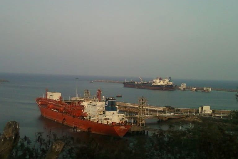
Paradip Port is a deep-water port commissioned in 1966 and was labelled as the eighth major Indian port. Located between Kolkata in the north and Vishakapatnam in the south, the port site overlooking the Bay of Bengal was once a dense mangrove swamp used for hunting fish and collecting wood.
A bulk cargo handling port, it works round the clock all year and was badly hit during the 1999 super cyclone. Earlier this year it reached the milestone of handling 100 million metric tonne (MMT) cargo per annum.
Oceanographer Anirban Mukhopadhyay, who studies shoreline dynamics in the Mahanadi delta as part of the Deltas, vulnerability and Climate Change: Migration and Adaptation (DECCMA) project, said various stretches along the Odisha coast are undergoing erosion at an alarming rate and the situation is likely to worsen by 2050 in a business-as-usual scenario.
Mukhopadhyay, who was not associated with the modelling study, observed that the Mahanadi delta is undergoing erosion at par with the global rate and in some transects even more than the global average erosion rate.
“In ports such as Paradip, fortification would become absolutely necessary. Moreover, another issue is with the groundwater use pressure along the port area that puts the stretch at a risk of land subsidence,” added Mukhopadhyay of Jadavpur University, Kolkata.
Sustainability consultancy Asia Research and Engagement (ARE) in a 2018 report “Climate Costs for Asia Pacific Ports” estimated that the potential cost to upgrade 53 of the region’s largest port areas (including in India) to adapt to climate related risks would cost between US$31 billion and US$49 billion.
The report also recommended developing scenarios and projections relating to climate parameters including sea level, storm intensity/surges, wind speeds and temperature variability.
Erosion-accretion play-off
Studies have emphasised that one of the “major maintenance problems encountered by the shoreline harbours along the east coast of India is siltation of approach channels” due to huge sediment movement by wave action along the coast.
Since the development of the port in 1966, the site has witnessed accretion and erosion on either side. At these stretches, prior to the establishment of the port, the coastline was stable for a period of 60 years.

Study author Deo said the erosion and siltation happening in the past might accelerate due to increase in wind intensity and wave height. Higher wind and drift would mean stronger erosion and siltation.
“Accretion (siltation) may interfere with navigation when inlets fill up. It may result in accumulation of more sand in the navigation channel increasing dredging efforts while erosion of shorelines can resulting in dumping more sand in the dredged navigation channel or cause scouring of structures undermining their safety,” Deo explained.
At Paradip’s key-shaped harbour area, the approach channel to the port is flanked by two rubble mound breakwaters (north and south) and is connected to deep water by a dredged channel.
Breakwaters are walls constructed at an angle to the shore forming an artificial harbour that protects an area from wave action and creates calm waters to provide safe berthing for vessels.
Mukhopadhyay explained that the sediment movement and the accretion-erosion pattern changed due to the construction of these protection structures.
So a sea wall of five km length was erected along the northern side of the port.
Sea walls are engineered structures made of concrete or interlocking rocks and are built parallel to the shore to hold or prevent sliding of the soil, while providing protection from wave action (UNFCCC, 1999).
The researchers who carried out the present study said beach accretion and erosion at the port’s southern breakwater might go up by four metres and eight metres, respectively, from the current level, in another 25 years.

The study doesn’t consider the effect of the sea-level rise due to global warming in next 25 years, Deo pointed out.
“There are some past studies done by researchers working on Indian coasts saying that sea level rise at many Indian coasts may be of the order of one to two mm per year, which may not have significant impact on erosion/shoreline changes considered by us over around three decades. The erosion/accretion is more likely to be governed by changes in waves rather than those in sea level rise,” he elaborated.
It does not explicitly account for the effect of cyclones. “The impact of extreme events such as cyclones on a shoreline generally takes place for a short term and it is reversible,” the study notes, citing publications.
Bracing against the surge
According to Deo the study could come in handy while framing future port management strategies.
“Our recommendation would be to evaluate future local changes in coastal environment with the help of projected climate data and accordingly determine coastal erosion and accretion and further coastal vulnerability index afresh, instead of relying on historical data which may not portray true picture of the future,” Deo said.
India’s Sagarmala Programme aims at port modernisation, connectivity enhancement, coastal community development and new port development. As part of the initiative, six new port locations have been identified in the country.
They are at Vadhavan (Maharashtra), Sagar Island (West Bengal), Paradip Outer Harbour (Odisha), Sirkazhi, Enayam and Belekeri in Tamil Nadu.
Under the Sagarmala initiative, an extended outer harbour has been planned south of the existing port layout at Paradip.
According to a 2016 pre-feasibility report for development of the outer harbour, this extended harbour would require “two breakwaters to provide round the year wave tranquillity within the harbour.”
The report mentioned that a final layout and alignment of the breakwaters shall be decided based on the “wave tranquillity studies” and the length shall be kept minimum to limit the overall capital expenditure. In addition, the assessment also suggested preparing the new harbour to “satisfy the environmental requirements for preventing erosion” along the coast north of the port.
While building new ports or modernising existing ones, Deo said hydraulic modelling studies should be undertaken to factor in changes in wind intensity and waves due to climate change.
“Just because we apprehend changes doesn’t mean we have to stop port development. There are steps that we can incorporate during designing to counter these changes,” Deo said.
For instance, to deal with rogue waves, breakwaters can be constructed to incorporate design level changes while both structural and non-structural measures can be brought in to tackle increasing erosion and accretion.
“Geosynthetics offer a solution to erosion control in addition to plantation barriers. Dredging can help with issues of accretion and artificial beach generation can counter any negative effects of dredging,” Deo added.
CITATION
Gopikrishna, B., & Deo, M. C. (2018). Changes in the shoreline at Paradip Port, India in response to climate change. Geomorphology, 303, 243-255.
Mukhopadhyay, A., Ghosh, P., Chanda, A., Ghosh, A., Ghosh, S., Das, S., … & Hazra, S. (2018). Threats to coastal communities of Mahanadi delta due to imminent consequences of erosion–Present and near future. Science of the Total Environment, 637, 717-729.
Banner image: Paradip Port. Photo from Paradip Port Trust website.