
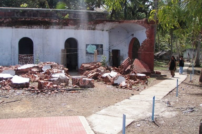
- In 2004, India suffered from one of the most devastating natural disasters when a tsunami struck the Indian coast. It led to over 10,000 deaths and several thousand people went missing. It resulted in extensive damage to property and crops as well.
- Subsequently, India had set up a tsunami early warning centre to predict any such event in the future and prepare the administration. Over the years, India’s centre has become one of the most modern tsunami warning centres of the world.
- Now, in a major update to the already advanced system, INCOIS has developed a mechanism to predict the extent of danger and damage in real time, once a tsunami occurs.
In a major development in India’s capability to assess dangers following a tsunami event, the Indian National Centre for Ocean Information Services (INCOIS) has now developed a system which will be able to predict risk to coastal areas, height of waves that can hit them and even pinpoint vulnerable buildings, all in ‘realtime’.
This will make India the first nation in the world to do so, said INCOIS, an institute under the Indian government’s Ministry of Earth Sciences (MoES).
“In the current scenario of tsunami forecast, India uses the earthquake information (location and magnitude) to provide coastal forecast of expected tsunami arrival times and expected wave amplitudes at beach along with threat status (warning/alert/watch/no threat) using tsunami scenario database,” said E. Pattabhi Rama Rao, a scientist at INCOIS, while explaining the new system to the Mongabay-India.
Pattabhi Rama Rao, the head of INCOIS’s Tsunami and Storm Surge Early Warning Services Group (TWG), said that the “capability of being able to run the propagation and inundation model in real-time will be beneficial to operational tsunami warning centres to reduce the uncertainties in tsunami forecasting.”
This would mean a major update to the present mechanism.
“If we run a model in real-time, we need not depend on scenario databases that are run using worst-case parameters. Instead, we can wait for real-time earthquake source parameters that can be derived within 15-20 minutes of the earthquake and use those for running the model in real-time. Those forecasts will be much more accurate than scenario-based forecasting (used at present),” Pattabhi added.
The model is being run on experimental mode and will be operationalised in the near future.
The government has identified a list of regions on the country’s eastern coast that are highly vulnerable to a tsunami. These include Puri, Kakinada, Machilipatnam, Nizampatnam-Vatapalem, Chennai, Cuddalore-Puducherry, Rameshwaram, Thoothukudi, Alappuzha-Chavara and Kochi.
“We have carried out a GIS mapping of these areas to the smallest possible detail (street and building level) including the socio-economic data. With this new model, in case of a tsunami event, we will be able to tell the areas are going to get hit, what time they will get hit and height of waves. The simulations will give a clear idea that which are the areas that can get inundated, the extent of inundation and up to which depth. It will even tell what kind of buildings that are vulnerable in these regions,” he added.

With this capability, India will be the first country that will be able to provide tsunami inundation warnings in real time. The system was developed over the past three-four years.
Once bitten, Indian scientists ramp up tsunami warning capabilities
Tsunamis are generated by earthquakes of a magnitude of more than 8.5 in the oceans. One such tsunami in the Indian Ocean in December 2004, led to massive destruction along the coastline of Tamil Nadu, Kerala, Andhra Pradesh, Puducherry and Andaman and Nicobar islands of India. It resulted in 10,749 deaths, 5,640 persons went missing, 2.79 million people got affected, 11,827 hectares of crops were damaged and about 300,000 fisherfolk lost their livelihood.
At that time, India’s apparatus to detect any such event or its extent was found lacking. Caught unawares, the Indian government had subsequently set up the Indian Tsunami Early Warning Centre (ITEWC) at INCOIS to provide early warnings to the entire Indian Ocean region, in case of an impending tsunami event..
Since then, Indian scientists have made rapid strides to achieve better and accurate prediction capabilities. In fact, the Indian centre is now considered as one of the most modern tsunami warning centres of the world providing information to India as well as several other countries in the region.
It was also designated as one of the Tsunami Service Providers (TSP) for the entire Indian Ocean region by the Intergovernmental Oceanographic Commission (IOC) of UNESCO in October 2011. Since then, it has been providing tsunami advisories and related services to all countries in the Indian Ocean Rim (25 Countries).
Realistic prediction of tsunami
Pattabhi stressed that with the new system, INCOIS will be able to give a realistic prediction – not overestimation or underestimation.
However, the system is yet to cover all the major areas. For instance, the new update will not cover the region of the Andaman and Nicobar Islands, a group of 572 islands in the east of the Indian mainland in the Bay of Bengal. “It will be added into the system in the future,” said Pattabhi.
Meanwhile, besides the new modelling system, INCOIS has been regularly organising mock drills and tests to check the preparedness of the entire chain of administration and find lacunae. One such mock drill was conducted last year in five coastal states on the eastern coast where mass evacuations were conducted in several areas.
The exercise was then analysed in detail and it was found that email was the most effective form of communication as many a time SMS does not reach. The mock drills also ascertained that in which states officials were quickest to reach on the ground in case of an alert.
A similar mock drill is now being planned in the first week of September of this year to review the preparedness during which there will be a mass evacuation of people living in vulnerable areas near the coast soon after the alarm is sounded.
Several workshops have also been conducted by INCOIS at the national and international level.
According to the MoES, the Indian Tsunami Early Warning System (ITEWS) comprises a real-time seismic monitoring network of 17 broadband seismic stations to detect tsunamigenic earthquakes.
In addition to that, INCOIS receives data from around 90 national seismic stations that are established by various national local and regional centres. It also has a real-time sea-level network with seven tsunami buoys in the open ocean and 35 tide gauge stations at different coastal locations to monitor tsunamis and pre-run scenarios database of tsunami. The ITEWC is also receiving data from around 350 seismic stations, 50 tsunami buoys and 300 tide gauges of other international agencies in real time.
“The centre is capable of detecting tsunamigenic earthquakes occurring in the Indian Ocean as well as in the global oceans within 10 minutes of their occurrence and disseminates the advisories to the concerned authorities,” said India’s Minister for Earth Sciences Harsh Vardhan in reply to a query in the parliament on August 8.
Banner Image: Tsunami in 2004 led to widespread damage in India. Photo by Kotoviski/Wikimedia Commons.