
- The India State of Forest Report 2019 released recently shows an increase of 5,188 square kilometres of forest and tree cover across the country compared to the ISFR 2017.
- However, the report highlights that northeast India continues to lose forests when compared to ISFR 2017 and previous reports.
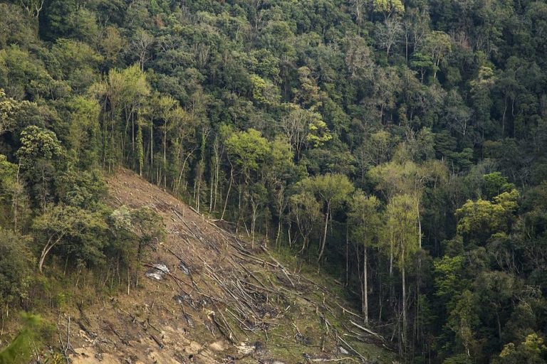
- The forest report also reveals that the forest area under the category “recorded forest area” (land notified as forest by the government) in tribal districts, which are home to about 60 percent of India’s forests, is decreasing as well.
- The report for the first time did an assessment of biodiversity for all states and union territories and found that Arunachal Pradesh has the maximum richness of species in terms of trees, shrubs and herbs followed by Tamil Nadu and Karnataka.
Nearly 25 percent (one fourth) of India’s total land area is now under forest and tree cover. However, there is still a long way to go – more than a decade, admits the government – before India reaches its target of having 33 percent of its total area under forest and tree cover. The latest ‘India State of Forest Report (ISFR 2019) released by the country’s environment minister Prakash Javadekar on December 30, 2019, revealed that the total forest and tree cover of the country is 807,276 square kilometres (which is 24.56 percent of the geographical area of the country) compared to 802,088 sq km (24.39 percent) in ISFR 2017. The report marked an increase of 5,188 sq. km. of forest and tree cover combined, at the national level, as compared to the previous assessment. When the last assessment, ISFR 2017, was released, an increase of 8,021 sq. km. was recorded compared to the data in ISFR 2015.
While the overall forest and tree cover marked an increase on a national level, the report highlighted a decrease in the forest area in the country’s northeast region. This decline in forest area in the northeast has been an ongoing trend with the region witnessing a loss of about 3,199 sq. km. of forest area sine 2009.
ISFR 2019 is a biennial report published by the Forest Survey of India (FSI) and is the 16th such report published. The calculations are largely based on satellite data. It includes information on forest cover, tree cover, mangrove cover, growing stock inside and outside the forest areas, carbon stock in India’s forests, forest types and biodiversity, forest fire monitoring and forest cover in different slopes and altitudes.
What does ‘forest cover’ include?
According to the 2019 report, the total forest cover of the country is 712,249 square kilometres (21.67 percent of India’s total geographical area) slightly up from 708,273 sq. km (21.54 percent) in 2017. The tree cover of the country is 95,027 sq. km (2.89 percent of the total area) again slightly up from 93,815 sq. km. (2.85 percent) in 2017.
As per the report, “forest cover” includes all tree patches which have canopy density more than 10 percent and area of one hectare or more in size, irrespective of their legal status and species composition. The term “Recorded Forest Area” (RFA) is used for lands which have been notified as “forest” under any government Act or rules or recorded as “forest” in the government records.
The report spotlights that forest cover within the RFA category has shown a slight decrease of 330 sq. km., whereas forest cover outside the RFA has shown an increase of 4,306 sq. km., as compared to the previous assessment of 2017.
Kanchi Kohli, who is a senior researcher with the Centre for Policy Research (CPR), said that the “logic of counting recorded forest area is misleading.”
“Most approvals for forest land diversion state that the legal status of the land will remain unchanged. This means that a dam reservoir that has submerged a forest or a steel plant will also be calculated as a recorded forest, even though no forest exists. It is important for the ISFR to look at a good forest with aspects like water security, biodiversity and livelihoods at the centre of understanding the state of forests rather than merely the canopy cover,” Kohli told Mongabay-India.
Read more: State of Forest Report says that India’s forest and tree cover has increased by 1 percent
India needs to double rate of forest cover expansion to achieve Paris Agreement target
“Since 2014 (when Prime Minister Narendra Modi led government assumed power at the national level), there has been an increase of more than 13,000 sq. km. of tree and forest cover in India (13,209 sq. k.m),” said Javadekar while releasing the report.
He stressed that India is the only country in the world that has witnessed an increase in all kinds of forests whether it is very dense forests, moderately dense forests or open forests.
The report noted that the gain in forest cover or improvement in forest canopy density may be attributed to better conservation measures, protection, afforestation activities, tree plantation drives and agroforestry whereas, loss in forest cover and impairment of forest canopy may be attributed to shifting cultivation, forest fires, felling of trees, natural calamities, anthropogenic pressure and developmental activities.

The environment minister did not elaborate on when India would be able to achieve the target of 33 percent of its total area under green cover. “Today, we are at 25 percent and we have to go to 33 percent. It will take a little time, not 2030. But with the cooperation of the people of India, we will achieve it much sooner than planned,” said Javadekar.
He stressed that India is on track to achieve its goals under the Paris Climate Agreement.
In 2015, just before the United Nations Framework Convention on Climate Change (UNFCCC) meeting in Paris, India had submitted its intended nationally determined contributions (INDCs), under which it had promised to create a cumulative carbon sink of 2.5-3 billion tonnes of carbon dioxide (CO2) equivalent by 2030.
As per the ISFR 2019, the total carbon stock in forests in India is estimated at 7,124.6 million tonnes. “There is an increase of 42.6 million tonnes in the carbon stock of the country as compared to the last assessment of 2017. The annual increase is 21.3 million tonnes, which is 78.1 million tonnes CO2 equivalent,” said the report.
MP has largest area under forest cover
As per the ISFR 2019, the top five states in terms of increase in forest cover are Karnataka (1,025 sq. km.), Andhra Pradesh (990 sq. km.), Kerala (823 sq. km.), Jammu & Kashmir (371 sq. km.) and Himachal Pradesh (334 sq km).
In terms of area, Madhya Pradesh has the largest forest cover in the country followed by Arunachal Pradesh, Chhattisgarh, Odisha and Maharashtra. In terms of forest cover as a percentage of their total geographical area, the top five states are Mizoram (85.41 percent), Arunachal Pradesh (79.63 percent), Meghalaya (76.33 percent), Manipur (75.46 percent) and Nagaland (75.31 percent).
The report also highlighted that there are 62,466 wetlands in the country and amongst the states, Gujarat has the largest area of wetlands (within the RFA) in the country followed by West Bengal. The report has identified wetlands of more than one-hectare area within the RFAs.
The ISFR 2019 also showed that the mangrove cover in the country has increased by 54 sq. km. as compared to the previous assessment. The maximum increase was in Gujarat which recorded an increase of 37 sq. km followed by Maharashtra (16 sq. km.) and Odisha (8 sq. km.) but it marked a decrease of mangrove cover in Tamil Nadu (four sq. km.), West Bengal (two sq. km.) and Andaman and Nicobar Islands (one sq. km.).
Forests in northeast region witnesses a decline
The forest cover in the northeast marked a decline as the current assessment showed a decrease of forest cover by 765 sq. km. compared to 2017 data. “Except Assam and Tripura, all the States in the region show decrease in forest cover,” it said.
The report noted that total forest cover in the northeastern region is 170,541 sq. km. which is 65.05 percent of its geographical area. Javadekar echoed the findings, saying, in the northeast already 70-80 percent of the land is under forest cover and the decrease is mainly because of shifting cultivation. “We will make a focused attempt for the northeast region as well,” said Javadekar.
The decline of the forest area in the northeast region is a continuous trend and since 2009 the region has witnessed a loss of about 3,199 sq. km. of forest area. For instance, when the ISFR 2017 was released, there was a decline of 630 sq. km. of forest cover compared to the ISFR 2015. The ISFR 2015 had marked a decrease of 628 sq. km of forest cover compared to the 2013 data.
The northeastern region of India comprises eight states – Arunachal Pradesh, Assam, Manipur, Meghalaya, Mizoram, Nagaland, Sikkim and Tripura – and is one of the 17 biodiversity hotspots of the world. Its importance can be underlined from the fact that the region, with just 7.98 percent of the geographical area of the country, accounts for nearly 25 percent of the country’s forest cover.
“The report and information about the increase in forest area is questionable as even plantations of all kinds including ecologically destructive teak and eucalyptus under the compensatory afforestation and other programmes are shown as forest. Importantly, such plantations are found to have been carried out in community lands affecting rights and livelihoods of tribal people and forest dwellers violating their rights,” Tushar Dash, an independent researcher on forest rights, told Mongabay-India.
Forests in hills are increasing but decreasing in tribal districts
The forest cover in India’s hill districts is 284,006 sq. km, which is 40.30 percent of the total geographical area of these districts, and according to the ISFR 2019, there is an increase of 544 sq. km. in 140 hill districts of the country.
The total forest cover in the tribal districts is 422,351 sq. km. which is 37.54 percent of the geographical area of these districts. There are 218 tribal districts identified by the government of India across 27 states and union territories.
“The current assessment shows a decrease of 741 sq. km. of forest cover within the RFA in the tribal districts and an increase of 1,922 sq km outside,” said the report even as it noted that forests play an important role in the socio-cultural and economic life of the tribal people.
“The ISFR 2019 indicates that close to 60 percent of the country’s forest cover is in tribal districts. It is important to keep in mind that these are the very same places where some of the biggest conflicts around land-use changes for mines, dams or roads have been located. The 100,000 plus trees of Talabira and many others of Hasdeo Arand have been at the centre of grassroots movements to conserve forest and wildlife. Even the ISFR 2019 reports decrease in forest cover in these regions,” said Kanchi Kohli.
Read more: Dark times await Odisha’s Talabira as forests razed for mining
The Hasdeo Arand story: Is coal mining a fait accompli for the pristine forests?

Dependence of people on forests
The report also quantified estimation of the dependence of people living in areas near forests for fuelwood, fodder, small timber and bamboo as it highlighted that more than 170,000 villages (of the total of 650,000 villages in India) are located in the proximity of forests.
It observed that people living in these villages are dependent on the forests for fuelwood, fodder, small timber, non-timber forest produce and bamboo to a great extent.
“But with the manifold increase in their population in the last 60 to 70 years, pressure on forests has also increased in the likewise manner. Most of these removals from forests, which take place in a gradual and continuous manner remain unrecorded. Thus, possibly a major driver of impairment of forest productivity remains unassessed and does not get adequate attention of policymakers and forest managers due to lack of data. There are no reliable estimates available which provide quantification of removal of these produce,” said the report while noting that it has conducted a study during 2018-19 to measure this dependency.
As per the study, in terms of total removal of fuelwood by the people living in forest fringe villages, the highest quantity of removal of fuelwood is estimated for Maharashtra followed by Odisha and Rajasthan. In terms of average removal of fuelwood per capita in a year, the highest dependence is observed in Nagaland followed by Himachal Pradesh and Tripura.
“It has been assessed that the annual removal of the small timber by the people living in forest fringe villages is nearly seven percent of the average annual yield of forests in the country,” said the report.
Meanwhile, the FSI in this latest report, for the first time ever, has carried out a rapid assessment of biodiversity for all states and union territories and “maximum tree diversity has been found in tropical wet evergreen and semi-evergreen forests of Western Ghats (Tamil Nadu, Kerala and Karnataka) followed by northeastern states.

“Low tree diversity has been noticed in the sub-tropical dry evergreen forests of Jammu and Kashmir and forest deficit States like Punjab, Haryana and Rajasthan. Among the States, Karnataka has the highest tree species richness followed by Tamil Nadu and Andhra Pradesh,” said the report.
“Karnataka has maximum species richness for trees, Arunachal Pradesh has maximum species richness for shrubs and Jammu & Kashmir has maximum species richness for herbs. Arunachal Pradesh has the maximum richness of species when all the three types of plants (trees, shrubs and herbs) are taken into account, followed by Tamil Nadu and Karnataka,” the report added.
Banner Image: India has recorded an increase in dense as well as open forests. Photo by BSSKrishnaS/Wikimedia Commons.