
- Scientists warn of underestimating the flood hazard of Brahmaputra by 24 to 38 percent, based solely on natural variations. This means destructive floods will probably be more frequent than scientists have thought.
- The concerns come amid reports of China’s and India’s plans to build large-scale hydropower projects on the river.
- Improved data sharing on Brahmaputra’s discharge is needed between China, India, Bangladesh, Bhutan, and Nepal.
Reconstruction of 700 years of the Brahmaputra river’s water flow in the monsoon season, based on tree-ring data, suggests that the transboundary river’s real flood risk is likely an underestimate as instrumental records were taken during a dry period, scientists warn in a study.
They call for improved data sharing between the basin states China, India, Bangladesh, Bhutan, and Nepal. The study comes amid reports of China’s and India’s plans to build large-scale hydropower projects on the river.
Many researchers agree that a warming climate will intensify the seasonal monsoon rains that drive the Brahmaputra, but the presumed baseline of previous natural variations in river flow rests mainly on discharge-gauge records dating only to the 1950s. However, data from rings of ancient trees in 28 different sites in Tibet, Myanmar, Nepal, and Bhutan in the Brahmaputra River watershed reveal that most recent decades of discharge (1956–1986) are among the driest of the past 700 years.
“That should be of concern to us because, in the present day, high discharge years are usually associated with flooding. So this means that we are likely underestimating the true flood risk in the river as we have only taken records during a dry period,” study’s lead author Mukund Palat Rao, Tree Ring Laboratory, Lamont-Doherty Earth Observatory, Columbia University, told Mongabay-India.
Anyone using the modern discharge record to estimate future flood hazards would be underestimating the danger by 24 to 38 percent, based solely on natural variations; human-driven warming would have to be added on top of that.
“If the instruments say we should expect flooding toward the end of the century to come about every four and a half years, we are saying we should really expect flooding to come about every three years,” said Rao. Discharge is the volume of water moving down a stream or river per unit of time.
The rings show that there have been much wetter periods in the past, driven by natural oscillations that took place over decades or centuries. The researchers found a good match for a high discharge in the year 1787 C.E. “We know from historical documents that there was a major flood in 1787 C.E. that caused the Teesta river to change its course eastward from flowing into the Ganga to the Brahmatpura instead. It was unclear if this shift was earthquake driven or monsoon driven,” Rao said.
“Obviously, we can’t say for sure, but our results suggest that 1787 was a very wet year. Though there still could have been an earthquake,” said Rao.
The study only talks about flood hazards, one of the three components of flood risk in terms of adaptation. Vulnerability and exposure are the other two. “In terms of policymaking, we can still reduce flood risk by reducing our vulnerability and exposure. So we need to continue to assess mitigation structures, e.g., embankments, polders, etc. to make sure they can withstand flooding both right now and into the future. Continuing to advance our early warning capabilities and flood action plans would serve us well,” said Rao.
This study’s primary motivation was to develop a longer discharge record to better understand the natural variability and high and low flow cycles seen in this river system. The researchers turned to dendrochronology — dating and interpreting past events based on tree rings.
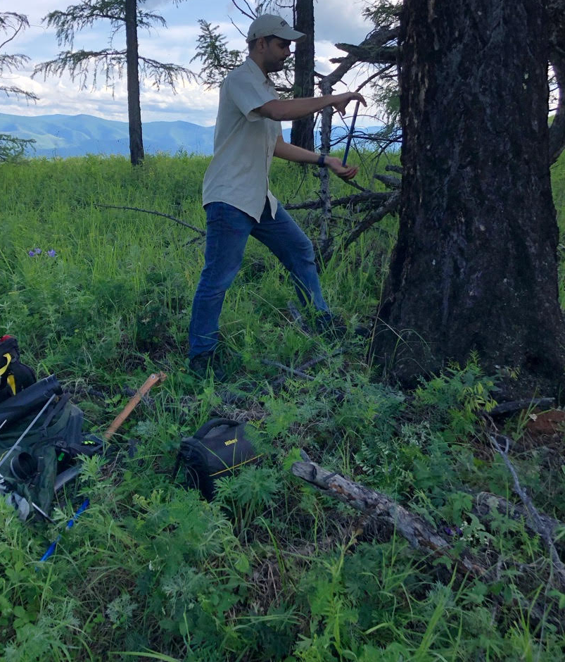
As trees grow they incorporate information about the environmental conditions they are living in, in their annual growth rings. Trees in the region grow more and put on wide rings in wet monsoon years. Conversely, in dry monsoon years (or droughts) they grow less and put on narrow rings.
“Since some of these trees can live for a long time, by taking a small pencil thin tree-core from these trees and measuring their rings under a microscope, we can learn more about climate conditions for the past several centuries. These cores that we take are small and do not injure or harm the trees,” added Rao.
Chandan Mahanta, professor and head of the Civil Engineering Department at IIT-Guwahati who was not involved in the study agreed that longer observation records would help overcome the current constraints of making robust baseline estimation of natural climate variability in hydro-climatologically complex river basins like the Brahmaputra.
“Focus only upon recent observation will be inadequate for accurate assessment of flood risk. Since long observation records from the past are not adequately available, alternative attempts are needed for synthetically generating reliable data,” Mahanta said. However, seven-century tree ring reconstruction of monsoon discharge alone may not provide an equally reliable database as that of instrumental measurement. “Such data is of best use if it can be integrated with data generated by other simulation tools for a collective agreement,” he added.
Shahjahan Mondal, professor and Director of the Institute of Water and Flood Management (IWFM) at Bangladesh University of Engineering and Technology (BUET), who was not involved in the study, underscored the significance of data sharing by basin states. “This will help not only flood and erosion management but also water management during the dry season,” Mondal told Mongabay-India.
Flowing under a variety of names and braided routes some 2,900 miles through Tibet, northeast India, and Bangladesh, the river, often described as a “moving ocean”, contributes nearly half of the approximate 40,000 m3/s (cubic metre per second) mean annual discharge of the Ganga–Brahmaputra–Meghna river system.
This makes it the joint third largest river system globally (tied with the Río Orinoco, Venezuela) in terms of its mean annual discharge after the Amazon and Congo. Known as the Jamuna in Bangladesh, the high discharge rates of the Brahmaputra are caused, in part, by annual precipitation (rain and seasonal snow) over 3000 mm/year for much of the watershed.
Its basin in India is shared by six states: Arunachal Pradesh, Assam, Nagaland, Meghalaya, Sikkim, and West Bengal. Majuli Island, the largest inhabited river island, is located in the Brahmaputra in upper Assam. The floods in the Brahmaputra valley are a recurring phenomenon and have been causing large scale devastations every year. However, the erosion by the Brahmaputra is more dangerous than floods. As with the Nile, the flooding has a good side because the waters drop nutrient-rich sediment to replenish farmland, and some degree of flooding is essential for rice cultivation.
Read more: Wildlife and people work together during Assam’s annual tryst with floods
Better data sharing between the basin states China, India, Bangladesh, Bhutan, and Nepal is essential, especially since the larger upstream countries (China and India) have more control over the water resources (particularly in the context of Bangladesh).
According to reports, in November 2020, China announced plans to develop nearly 60 GW of hydropower in the lower reaches of the Yarlung Tsangpo (the Brahmaputra in India) amid apprehensions of diversion of water from the river to irrigate drier regions in northwest China. This was followed by reports of India’s announcement on December 1, 2020, to build a 10 GW on the Siang (the stretch of the Brahmaputra in Arunachal Pradesh).
Rao told Mongabay-India that the project may not have such a large impact on wet/monsoon season flows because most of the precipitation originates south of the Himalayas. But any diversion of flow would negatively impact dry season flow which is derived from snow and glacial melt (from the Tibetan Plateau).
A reduction in dry season flow by a dam would raise water security concerns (not so much of an issue in the wet season) and concerns about saltwater intrusion in the low-lying Sundarbans delta, where a high river discharge rate holds back the ocean’s saline waters. This is again a concern only in the dry season when flow levels are lower, he added.
An additional layer of worry is associated with dams triggering loss of sediment. The river has one of the highest sediment loads in the world. These sediments are crucial to sustaining the floodplain’s fertility (for agriculture) and maintaining the large riverine islands (chars). “Dams inevitably trap sediments and reduce their load. In the long run, this could threaten the integrity of chars (sandbars or small sandy islands), many of which are currently inhabited. On the Indian side in Assam, this also could interact with regional politics as there is already a lot of discrimination faced by communities who live on chars in Assam,” said Rao.

The region is active tectonically (earthquakes) and the Brahmaputra is a highly braided river that migrates its course quite often. Both of these are other large risk factors in addition to flood concerns. “The flood and river management measures adopted so far in the valley are area-specific and mostly of short-term structural measures such as the construction of embankments, permeable and impermeable spurs, revetments, etc. The poor maintenance of the flood management structures generally causes unexpected miseries to the people in their failure,” said Rao.
“The efficacy of these measures, especially in the Brahmaputra river system, which is highly aggrading/degrading in different reaches, is also debatable. As such, there is a need for constructing storage reservoirs in combination with other structural/non-structural measures after studying the river behavior using scientific tools,” he added.
Banner image: Aerial view of the heavily braided Brahmaputra river. Photo by Ashwin Kumar/Wikimedia Commons.