
- India’s 2022 Wetlands Change Atlas mapped 231,195 wetlands, covering 4.86 percent of the country’s geographical area. The Atlas concluded that the number and extent of these wetlands have increased during the 2006/7-2017/18 period.
- Given that mapping wetlands is a complex task, 2022 Atlas likely presents the lower bound of the actual wetland extent in the country and the overall number is higher than what is recorded.
- It is high time that the wetlands mapping exercises graduate into a National Wetland Inventory Programme, which can, based on the extent and environmental condition of wetlands, be used for decision-making on wetlands protection, management and restoration, writes Ritesh Kumar in this commentary.
- The views in this commentary are that of the author.
On World Wetlands Day this year on February 2, the Ministry of Environment, Forest and Climate Change (MoEFCC), Government of India, released the National Decadal Wetlands Change Atlas (2022 Atlas). Published by the Space Application Center (SAC), the 2022 Atlas provides data on wetland number and extent in 2017-18 and an assessment of change in data since 2006-7 which was recorded in the National Wetlands Atlas 2011. In a marked improvement from the previous iteration, the 2022 Atlas also presents basin-wise and biogeographic zone-wise information on wetlands distribution and extent.
Much ground has been covered since the time wetlands inventories were prepared using questionnaire surveys, first initiated in the eighties, leading to the Directory of Wetlands published by MoEFCC in 1989. In 1998, the first satellite-data-based national wetlands inventory using remote sensing images of 1992-93 was published, pegging the extent of wetlands in India at 7.58 million hectares. The 2022 Atlas uses IRS Resourcesat-2/2A LISS III satellite data to map wetlands.
Natural wetlands are declining, human-made wetlands are increasing
The 2022 Atlas concludes that the number and extent of wetlands having areas equal to or greater than 2.25 hectares (ha) have increased during the 2006/7-2017/18 period. The Atlas maps 231,195 wetlands (having an area equal to or greater than 2.25 ha) spanning 15.98 million hectares (4.86 percent of the country’s geographical area). In the 2006/7, 212,385 wetlands (>=2.25 ha) spanning 15.34 million ha were reported. Thus, the assessment concludes that in a decade, the number of wetlands has increased by 18,810, and the area by 0.64 million ha.
The assessment states that natural coastal wetlands are declining (from 3.69 million hectares to 3.62 million hectares in ten years). An increase in the area has been reported for mangroves (by 18,662 ha), creeks (26,929 ha), and coral reefs (2,784 ha); however, the inter-tidal mudflats have receded by 116,897 ha, and so have salt marshes (by 5,647 ha). Gujarat stands out as the state with the most extensive loss of mudflats.
The natural inland wetlands have remained mainly stable, marginally increasing (from 42,157 to 42,779 in terms of numbers and from 6.93 million ha to 7.02 million ha in terms of the area during 2006/7-2017/18).
On the contrary, the human-made wetlands recorded a consistent increase. The area under saltpans increased by 93,139 ha, and aquaculture ponds increased by 15,692 ha. West Bengal and Odisha have seen the most significant increase in area under coastal aquaculture.
Similarly, all inland human-made wetlands increased during the two assessment cycles. Of the 0.52 million ha increase in the inland human-made wetlands, a majority was accounted for by reservoirs and barrages (0.31 million ha), tanks and ponds (0.15 million ha) and inland aquaculture ponds (0.06 million ha). Much of this increase has occurred in Maharashtra, Madhya Pradesh, Andhra Pradesh and Telangana.
The report also mentions that during 2006/7-2017/18, 308 natural wetlands (7,470 ha) were lost, whereas 811 new wetlands (22,673 ha) were recorded. In the human-made wetlands category, 1,034 wetlands (17,819 ha) were lost, whereas 14,012 new wetlands (388,995 ha) were recorded.
Running a confidence test
Mapping wetlands is a complex task, as the term groups together a range of aquatic habitats with common features such as the continuous, seasonal or periodic inundation, presence of water-loving macrophytes (also called hydrophytes), and saturated soils. Multiple gradients exist between non-wetland and wetland areas and within wetlands. Given this diversity, most assessments use active and passive remote sensing data from the electromagnetic spectrum to produce high-quality maps. Many indices and models are used to retrieve information for different wetland features, thresholds for which are set on the basis of test cases requiring human judgement. Often, ground truthing of the images is used to resolve estimation errors, but for a large country like India, producing high-accuracy maps becomes a tedious task and needs to be supported, at the very least, by remote sensing and GIS teams working in tandem with wetland ecologists. Variations in the wetland extent capture determined by the analysis of satellite data and the ground condition are thereby not uncommon. It would be not unfair to assume that the 2022 Atlas presents the lower bound of the actual wetland extent in the country.
When the Wetland Authority of NCT of Delhi called on the line departments to submit a list of wetlands, the overall number was over three times what is reported in both cycles of wetlands mapping.
Notably, there are significant variations in the wetland extent reported in the 2022 Atlas and assessments carried out in the same timeframe. The National Center for Sustainable Coastal Management (NCSCM) reports the total extent of coastal ecosystems in the country to be ~7,800 km2. Areas reported under mudflats and salt marsh by NCSCM and 2022 Atlas are at wide variance. Similarly, the area of aquaculture reported in the 2022 Atlas is at a variance of nearly 25% from other published assessments.
The wetland map in the 2022 Atlas has significantly low wetlands density for some parts of the country, such as Bihar, compared with neighbouring regions with similar geomorphology.
The increase in natural inland wetlands calls for close introspection. Wetlands are formed in topographic depressions and shaped over a long period by complex geological and hydrological processes. In the trans-Himalayan and Himalayan regions, the formation of new wetlands has been reported for quite some time, primarily linked with deglaciation. However, in other regions, the formation of new natural inland wetlands needs scrutiny. In a short timeframe of a decade, as the report refers to, wetland formation is more likely to be attributed to human-induced landscape alteration. The increase in wetland number may also be indicative of increased fragmentation.
Optical images alone may not be sufficient to map the total wetland extent in its full diversity. For mangroves, augmenting optical data with shortwave infrared channels has provided good discrimination from adjoining natural forests and plantations. Peatlands, which are incredible carbon pools, have failed to figure in any wetland assessment thus far, despite their presence being recorded in the high-altitude Himalayas and coastal regions. Radar satellite observations, which allow penetration below the canopy, have been globally found useful for mapping these wetlands. Similarly, unique coastal wetlands such as seagrasses can be mapped using hyperspectral aerial photographs, which can not only assist in distinguishing these wetlands but also compute features such as species composition, percentage cover density and leaf area index. Segregating perennial from non-perennial wetlands effectively may best be done with a mix of optical and synthetic aperture radar data.
Multiple approaches for establishing wetland boundary exist in India, and not all of these follow the presence of wetland indicators. The boundary of East Kolkata Wetlands, an assemblage of sewage-fed fish farms on the eastern fringes of Kolkata City, includes a large chunk of agricultural lands, which collectively assist in treating wastewater, the primary ecosystem function of these wetlands. In Vembanad-Kol, an estuary-floodplain agriculture complex in Kerala is defined based on connected hydrological regimes, delineating which requires an understanding of natural and modified hydrology. Such cases call for coupling remote sensing data with extensive ground truthing and incorporating information from multiple sources.
Time to rethink wetlands inventory
India has made significant strides in wetlands mapping, and the 2022 Atlas is an important contribution. However, wetland inventories in national plans and programmes have been very peripheral for various reasons. Several aspects need reconsideration while the next iteration of these assessments is considered.
The first issue relates to wetlands classification system, which is a foundational step for wetlands conservation and should be relevant to policy and decision-making. The 2022 Atlas, as well as the 2011 Atlas, use a modified Ramsar typology. The original Ramsar has 42 wetland types which enable designation of Wetlands of International Importance, yet, do not render easily to national inventories as it is not systematic classification (a mix of biological, physical, chemical and other criteria are used without a unifying classification scheme).
The 2022 Atlas uses a three-level classification. At the first level, the classification system places wetlands in either of the two categories (inland and coastal), and at the next, each wetland is assigned to the natural or man-made category. At the third level, the wetlands are placed in either of the 20 categories (13 natural and seven man-made).

It may be pertinent to question the overall purpose of this classification scheme – and whether it enables better management or policy targeting. Classification systems based on ecosystem structure attributes (such as hydrology or plant communities) do not readily lend themselves to attribution of ecosystem functions (such as their ability to moderate floods and droughts), which are more relevant for the use of inventory information by different sectors. Countries such as the United States, Brazil and South Africa have therefore included classification systems that can also address ecosystem functions by bringing in attributes such as the direction of water flow and relative position in a basin. This is also important as the goal of mainstreaming wetlands in sectoral planning requires a description of ways in which wetlands can address sectoral challenges such as flood and drought mitigation and pollution abatement.
The second issue pertains to data accessibility. The 2022 Atlas, as well as its previous iteration, have been produced as printed maps. These are of little help for on-ground action. The wetland inventory data must be available on a spatial platform for use by various stakeholders. And the ease-of-use matters. An example is the National Wetlands Inventory of the United States, maintained by the U.S. Fish and Wildlife Service, which is a publicly available resource. One can zoom in and out to see where the boundary of individual wetlands lie.
Thirdly, the use of a single scale for mapping wetlands, while it has its advantages in terms of comparability, it also has its disadvantages. Zooming into the wetlands becomes difficult, especially smaller wetlands – which account for a majority of the regime. The technological limitation of being unable to map wetlands below 2.25 ha in the two atlases with certainty has had an unintended effect of these wetlands being left out of key policy decisions. The Supreme Court, in its judgement in the famous M.K.Balakrishnan versus Union of India case verdict of February 8, 2017, directed that all wetlands >2.25 ha and mapped in the 2011 atlas stand the receive protection as indicated in Rule 4 of the Wetlands (Conservation and Management) Rules, 2017.
Finally, data on wetland number and extent alone may be insufficient to provide insights into wetland status. While the trends in number and extent can give some information on physical modification (through encroachment and fragmentation), the quality of remaining wetlands may still be declining due to various factors. Wetlands atlases need to integrate additional information layers – such as water quality of Central Pollution Control Board; water and climate-related parameters available on India Water Resources Information System, and information on wetland species available on platforms such as e-bird and Asian Waterbird Census. Several states have been innovative in this aspect. The Haryana Pond and Wastewater Management Authority maintains an extensive digital database on various issues, including management plans. Similarly, the Uttar Pradesh State Wetlands Authority has created a digital inventory of nearly 300 wetlands in the floodplains of River Ganga, containing detailed information on their physical features, biodiversity and ecosystem service values, threats and management arrangements.
From mapping to on-ground action
The 2022 Atlas, despite its limitations, underlines that natural wetlands continue to be under duress, with the pace of degradation of natural coastal wetlands being higher. States, where these trends are conspicuous have been identified that already is a good starting point to enhance conservation and management efforts.
The Atlas also indicates that the focus on specific wetland types – especially on the increasing area under mangroves– has been counterproductive, as the increase has been at the cost of mudflats – which have an ecological significance of their own. While mangroves have received high policy attention, especially with recurrent cyclones and floods, other coastal wetlands have not received equal attention and conservation action. Loss of mudflats severely compromises their ability to store carbon, buffer inland landforms from erosion, and provide habitats to diverse landforms, especially shorebirds, populations of which are in decline globally. The Atlas underlines the need for taking a more holistic view of coastal wetlands – and adopting a coastal zone-wide conservation intervention.
It is high time that the wetlands mapping exercises graduate into a National Wetland Inventory Programme, which can, based on the extent and environmental condition of wetlands, be used for decision-making on wetlands protection, management and restoration. Clear identification and statement of purpose and objectives form the very basis of an effective and cost-efficient inventory. The National Wetlands Programme (the National Plan for Conservation of Aquatic Ecosystems of the MoEFCC) states its objective as ‘mainstreaming the full range of wetland ecosystem services and biodiversity in developmental plans and programs at all levels’. To cater to this objective, the national inventory programme should enable the layering of wetlands information with other development information (such as water security, basin fragmentation, poverty incidence and others) to identify dovetailing opportunities.
The National Wetlands Inventory should, at a bare minimum, bring to the rest the multiplicity of terminologies and definitions that are used for wetlands by different sectors. Several documents of the Ministry of Jal Shakti, for example, refer to wetlands as waterbodies. Yes, wetlands have water, but that is not all – these are ecosystems with diverse lifeforms performing critical functions in the landscapes. Water is but one element of these ecosystems. The National Wetlands Inventory should bring all information on these ecosystems available with various agencies within a single spatial framework, enabling coherent decision-making.
Wetland inventory exercises are multi-disciplinary and cannot be entrusted with a team of remote sensing specialists alone. Engaging wetland managers, subject matter experts, and other stakeholders is crucial to ensure that the information generated is used to enhance and guide conservation and management actions.
Finally, there have been considerable advancements in combining optical and radar satellite images, coupled with machine learning approaches using big data for mapping ecosystems. Allowing multi-scale data to be integrated within a spatial framework can improve accuracies for wetlands, especially for smaller wetlands with unique characteristics.
As is widely quoted, a “good-looking” wetland map is no guarantee of a “good” wetland map. With our extensive technical capabilities, we must progress to the latter.
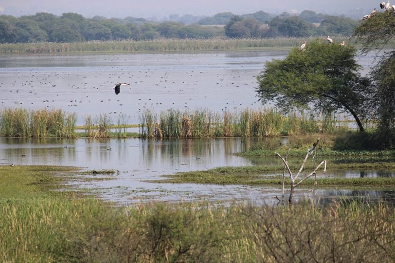
Banner image: Wetlands near Doriya River of Majuli, Assam, India. Photo by Dhrubazaan Photography/Wikimedia Commons.