
- Environmental geographer Ruth DeFries, who has extensively worked in the tropics to unpack deforestation using satellite data and field surveys, says, understanding of local drivers and context of deforestation is crucial to contributing to reducing deforestation.
- Land management strategies, such as agroforestry in Central India Landscape, can contribute to Net Zero but these solutions should have tangible benefits for people.
- In this interview with Mongabay-India, Ruth DeFries talks about connectivity, sustainable development and land use change in the Central India landscape.
Buoyed by a “geographer’s heart”, environmental geographer Ruth DeFries started using satellite data in the 1990s to generate global vegetation maps to feed climate models.
Unraveling drivers of deforestation in tropical forests, including the central Indian landscape (CIL), a globally important tiger conservation area, DeFries says people of the landscape should have the ability and the options to meet their aspirations, including moving away from forests.
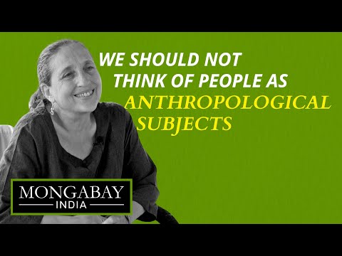
“We should not think of them as anthropological subjects or people who should be kept in the forest with their traditional way of life, if they have different aspirations. So, whether that is remaining being forest-dependent or whether that’s moving out or whatever their aspirations are –people are able to meet, like everyone else,” DeFries told Mongabay-India in an interview on the sidelines of the Central India Landscape Forum in Madhya Pradesh.
“We tend to first come from the conservation angle and then bring in local communities. We need to flip that.”
DeFries, who has research and familial ties (by marriage) in the CIL, is a professor of ecology and sustainable development at Columbia University in New York and co-founding dean of the Columbia Climate School. She uses images from satellites and field surveys to examine how the world’s demands for food and other resources are changing land use throughout the tropics.
Confessing to being “smitten” by the CIL, she has been part of the conversation on connectivity, sustainable development and land use change in the landscape for over a decade ever since her on-ground project on mapping tourism expansion in India’s protected areas.

Her lab’s research has contributed to the growing body of knowledge on connectivity in the tiger conservation area, barriers to tiger movement mitigation structures to prevent wildlife casualties. Collectively, this body of research has helped galvanise action leading to the construction of an overpass in the Kanha-Pench corridor.
“That was just amazing to watch and that was the hard work of so many people fighting, raising the legal issues and making that happen,” she recalls.
Acknowledging the importance of tigers, a charismatic species and India’s national animal, in drawing attention to appreciating nature and conservation, DeFries also stresses on going “beyond just chasing after the tiger.”
“What really matters the most is healthy soil. Healthy grasses, that is not charismatic at all. That’s very hard to communicate. So, I agree with the point that we have to be thinking about multiple species, including plants,” she said.

Growing up in the Washington D.C. area in the United States, DeFries had the ring-side view to the local environmental issues such as the Potomac river pollution and air pollution. A mother and a grandmother now, DeFries also saw movements such as the first Earth Day in 1970 that sparked demonstrations across the U.S. and government action eventually leading to the creation of a new federal agency to tackle environmental issues, the U.S. Environmental Protection Agency.
“That time (since the first Earth Day) I knew I wanted to devote my life to a safer and a healthier world for everyone on the planet,” she says in a video clip for Science Moms, a group of nonpartisan climate scientists and mothers who aim to “demystify climate science and motivate everyday moms to demand climate change plans and solutions that preserve the planet for our kids.”
Environmental literature such as Frances Moore Lappé’s Diet For A Small Planet and Rachel Carson’s Silent Spring also had significant impacts on a young deFries who eventually went on to formally explore her interests in land use as an integrator of human interaction with the natural world (terrestrial) as an environmental geographer.
Comparing notes on what she discovered using satellite data to map deforestation in different regions in the tropics, she recounts that in Brazil in the early 2000s the spike in deforestation due to soy trade was obvious from satellite imagery and also in ground truthing exercises.
“… deforestation occurs very rapidly with tractors and chains (strung) between the tractors just running down all the trees, so it’s very, very different from what you have here (India) where there’s small scale, very small land holdings, small fields, and you don’t have that kind of massive deforestation.”
“The Brazil deforestation mapping really wasn’t much of a remote sensing challenge, because it’s so easy to see because it’s so massive. Here (in India) the view from the sky doesn’t tell you a lot. You really have to get down to the ground, because the processes are so small scale.”

These drivers and processes are still hard to see despite advances in satellite-based mapping. In terms of access, the very high-resolution data is commercial. “It’s not publicly available. There is still high resolution but coarser (data) that is publicly available, but the very high resolution is in the private sector domain which restricts activity,” she said.
“And there’s no way you can understand the interaction between people and the forest from above,” says DeFries, discussing her motivation to go on the ground.
“One of the things we really have to keep in mind when we have these big goals about reducing deforestation is that there isn’t one driver and there’s a different context in different places.”
While land management can contribute to Net Zero, it can be “tricky.” A recent study that she co-authored says the voluntary carbon market needs to embrace changes for the land sector.
“And why it is so tricky is because we could store carbon and we will make all this forest again, but people need to eat, people need to live somewhere. So how do you create a system where something like the carbon market can achieve the benefits but not displace people or not be harmful for what people need for their livelihoods and food security,” she explained.
“I think that land management is not the solution to reducing greenhouse gas emissions. You know, the major contributor is the energy sector. So I think there’s been a bit of hype about how much so-called, nature-based solutions can actually contribute to solving the climate problem.”
For Madhya Pradesh, she says there’s potential for agroforestry, planting trees outside the protected areas that are on private lands, as a land management strategy to contribute to Net Zero but “it is not going to solve the climate problem but could contribute (in addressing it)” but these solutions should have tangible benefits for people – for example, livelihood or economic benefits.

Through her books, The Big Ratchet: How Humanity Thrives in the Face of Natural Crisis and What Would Nature Do?: A Guide for Our Uncertain Times, DeFries has discussed how natural systems deal with environmental stress and lessons from nature in dealing with environmental crises.
And one literally foreshadowed what was to come.
She completed the manuscript for What Would Nature Do?: A Guide for Our Uncertain Times which talks about maintaining diversity – such as diversity in supply chain diversity, livelihood strategies, crop species – to bounce back from shocks, right before the COVID-19 pandemic.
“The pandemic hit, and everybody started talking about diversifying the supply chain and all these ideas that relate and go back to nature,” she said.
Her research group is also focusing on bringing back millets as a staple in landscapes where they previously were the hallmark of people’s diets. “They are so appropriate for landscapes like this: more arid landscapes, more climate resilient cereals. And we’ve been working on this to look at climate resilience, look at nutrition,” DeFries adds.
Read more: A plan to help forest fringe communities deal with COVID-19
Banner image: Scientist Ruth DeFries spoke to Mongabay-India at the Central India Landscape Forum in Madhya Pradesh. Photo by Kartik Chandramouli/Mongabay.