- An international team of scientists has developed a new decision-making tool to identify high conservation-value areas (HCVAs).
- Using this tool, the researchers have identified HCVAs for 50 rare, endemic, and threatened species in the high altitude Changthang landscape in India.
- More than 60% of the total geographical area of the Changthang plateau has been identified as HCVAs for these species, and much of these areas fall outside of the Changthang Wildlife sanctuary.
- The researchers recommend that the HCVAs that serve as refuges, breeding sites and corridors be regularly monitored to control disturbances such as tourism and overgrazing, quarrying, sand mining and improper waste disposal. They also recommend regular monitoring of important bird nesting sites to track changes caused by climate or land-use changes.
In conservation practice, how are protected areas identified and delineated?
The first step in this is to be able to describe a protected area. According to the International Union for the Conservation of Nature (IUCN), a protected area is ‘a clearly defined geographical space, recognised, dedicated and managed, through legal or other effective means, to achieve the long-term conservation of nature with associated ecosystem services and cultural values’.
Although this definition is fairly succinct and clear, a major stumbling block in conservation efforts is due to the difficulties in the practical identification of such ‘geographical spaces’ that help with the ‘long-term conservation of ecosystem services and cultural values’, which are unfortunately, subject to humans’ views of what is ‘useful’ and ‘not useful’ to them.

For example, in India, open natural ecosystems such as grasslands are often termed as ‘wastelands’ by policymakers and planners. These natural ecosystems have historically been and even now are, the focus of ‘(un)scientific reforestation’ efforts that threaten the land and leave it vulnerable to degradation. However, there is now hope that science can come to the rescue of conservationists and policymakers to help them identify important areas where conservation efforts can be focused.
A new tool for crafting conservation policies
A team of scientists have developed a decision-making tool to identify high conservation-value areas (HCVAs) to help habitat management practices in various landscapes. The tool has been tested on the Changthang landscape in Ladakh and a list of specific conservation practices have been developed based on the results of this study. The team included scientists from the University of Manchester, World Wildlife Fund (WWF)-India, National Tiger Conservation Authority (NTCA), and the United Nations Development Programme (UNDP).

The tool is based on the high conservation values (HCV) system that was established by the Forest Stewardship Council in 1999, which was used to certify forest management systems.
The first ‘HCV toolkit’ was published in 2003 by Proforest and identifies six types of areas that have high conservation values: (1) HCV1 areas contain high species diversity, especially of rare, endemic, and/or threatened species; (2) HCV2 areas are landscape-level ecosystems, ecosystem mosaics, and intact forests with viable populations of a large majority of naturally occurring species of that area; (3) HCV3 areas are ecosystem habitats for rare, threatened, or endangered ecosystems or refugia; (4) HCV4 areas are those that provide basic ecosystem services such as water catchment areas and those zones that control the erosion of vulnerable soils and slopes; (5) HCV5 areas are sites that provide the basic necessities (food, livelihood, health, etc.) for local or indigenous people; (6) HCV6 are sites that are of global, national, or historical importance and also of cultural, economic, ecological or religious significance for local/indigenous communities.
Using the definitions of HCV1, HCV2 and HCV3, the researchers developed their tool as a scientifically robust and replicable method to identify HCVAs that contained rare, endemic and threatened species at a regional and landscape level.
The method consists of three main steps. The first is to draw up a list of important species in a landscape using databases like the Global Biodiversity Information Facility (GBIF) and ebird, literature surveys, field visits, and discussions with wildlife experts. The second step is to visualise the species distribution patterns (using spatial distribution models or SDMs) to assess the landscape for suitable habitats of the important species. The last and third step uses a spatial algorithm based on niche overlap analysis that was developed in the study to identify areas that have the highest densities/occurrences of the selected species.
The researchers chose to test out this methodology on the Changthang plateau in Ladakh, which is one of the highest inhabited regions in the world (at an altitude of 4,000–7,000 metres above sea-level). This area has high-altitude steppes and rolling mountains dotted with lakes, wetlands, and river basins and is home to a surprisingly large number of plants, animals, and birds, despite the harsh environment.
Read more: Glaciers at Pangong in Ladakh are retreating
What does the HCVA analysis of the Changthang landscape indicate?
The study used 50 rare, endemic, and threatened species (32 plants, 10 animals, and 8 birds) from the Changthang plateau to identify HCVAs in this landscape. The species included the iconic snow leopard, Tibetan wild ass, Tibetan wolf, black-headed crane, and bar-headed goose amongst others.
“Our results show that the HCVAs for these species cover about 62% of the total geographical area of Changthang, most of which fall outside of the protected areas,” says Mehbub Sahana, one of the researchers involved in developing the tool for identifying HCVAs and the lead author of the paper that describes the tool.
“The HCVAs for these species are spread across rocky and grassy slopes, scree, shrubland, subnival zone (which lies above the tree-line and just below the snow-line), semidesert pasture land, and alpine grassland. For most of the birds, the HCVAs were observed near major lakes, other water bodies, marshes, river belts and other wetlands. Major intersections between the HCVAs for the plants, birds, and animal species used in this study were observed in central and southern Changthang,” he adds.

“An area like the cold-desert of Changthang is generally considered ‘barren’ or ‘waste’. But it actually supports so much life and diversity. An important result of this work is that it has helped us identify areas that are crucial not only for the animal and bird species, but also for plants and vegetation,” says Abhishek Ghoshal, a conservation ecologist who was involved in the work.
Abhishek points out that increasingly, poorly planned land-use changes are impacting natural ecosystems and the services they provide. “The HCVA approach allows a robust assessment of the conservation value of an area not just from the perspective of wildlife or vegetation, but also socio-economic and cultural values, with the intended goal of securing the services for humanity and the future.
Therefore, blending the conservation of biodiversity, ecosystem services, and socio-culturally important sites during developmental planning is an integral part of the development process, rather than a barrier or compromise,” he says. “Therefore, the HCVA approach can be a game-changer in giving policy makers a clear-cut understanding of priority areas for protection while planning for land-use changes or developmental /infrastructure projects with large-scale implications in a region,” he adds.
Based on the results of the HCVA analysis of the Changthang landscape, the researchers have also been able to formulate a set of specific recommendations for this area. They recommend that the HCVAs that serve as refuges, breeding sites and corridors be regularly monitored to control disturbances such as tourism and overgrazing. They also recommend regular monitoring of important bird nesting sites to track changes caused by climate or land-use changes. This can help in amending conservation strategies and modifying conservation areas to adapt to environmental challenges. In addition to these, the study recommends that all HCV1 sites be protected from quarrying and sand mining, and that plastic pollution and waste disposal be strictly controlled. Finally, the study also recommends that the defence forces in the area, departments in charge of wildlife protection and sheep husbandry work together to maintain the health of pastures and grasslands.
Read more: [Interview] Conservationist MK Ranjitsinh Jhala on the need for a grassland policy in India
What can the HCVA-based tool be used for and where can it be applied?
This HCVA approach can be applied anywhere in the world at different spatial scales, and is already being applied in some parts of Africa and Europe.
“The methodology described in our study can be used to identify and map HCVAs for rare, endemic, and threatened species at the landscape level and can be easily adapted to and adopted at the national, regional, state, or local levels in India,” says Sahana. “In fact, the approach taken for this study may be applied to many other taxa in varied geographical regions and thus can be used to formulate novel strategies and action plans for biodiversity conservation at the national/regional/local level in any part of the world,” he states.
Once the HCVAs are identified, Sahana explains that the knowledge can be used in many different ways. For example, the identified HCVAs can be used for ecological restoration and it may even be possible to increase the populations of selected species within these areas through specialised management practices. “In areas where the HCVAs for plants, animals, and birds intersect (like riverine forests, wetlands, or refuge sites), habitat reconstruction methods can be applied,” he says. “Along with this, the identification and mapping of HCVAs can be useful for Environmental Impact Assessment (EIA) studies and framing environmental crisis mitigation policies,” he adds.

Manvi Sharma, an assistant professor at Ashoka University, who works on community ecology in the Transhimalaya region notes that conducting field surveys in the high Himalaya poses significant difficulties due to harsh weather conditions and the potential risks associated with conflict-affected regions.
“The HCVA approach, which combines information on species detections from a variety of sources – GBIF, ebird, scientists, and local people – to create species distribution maps, is an excellent first step, especially for high altitude regions, for conservation assessment studies,” she says.
However, Sharma cautions that as an important next step, the SDMs need to be supported and validated using carefully designed surveys for robust assessments.
“Using data from planned surveys can help in estimating bias and uncertainty on parameters more reliably. I see promise in this approach as there is now a growing body of literature on how citizen-science data can improve the accuracy of SDMs built from planned surveys. It is heartening to see comprehensive studies conducted on the diverse and elusive plant and animal species inhabiting the high-altitude region, especially considering that the iconic snow leopard was only photographed in the wild as recently as 1970,” she adds.
CITATION:
Sahana, M., Areendran, G., Sivadas, A., Raj, K., Sharma, D., Sultan, M. S., … & Parameswaran, S. (2023). Assessing high conservation value areas for rare, endemic and threatened (RET) species: A study in high altitude Changthang landscape of India. Journal for Nature Conservation, 73, 126406.
The work described in this article is a part of the SECURE Himalaya project funded by MoEF&CC, Government of India and UNDP. The study has been conducted at WWF-India during 2019-2020.
Read more: Using citizen science to track illegal wildlife trade in the Himalayas
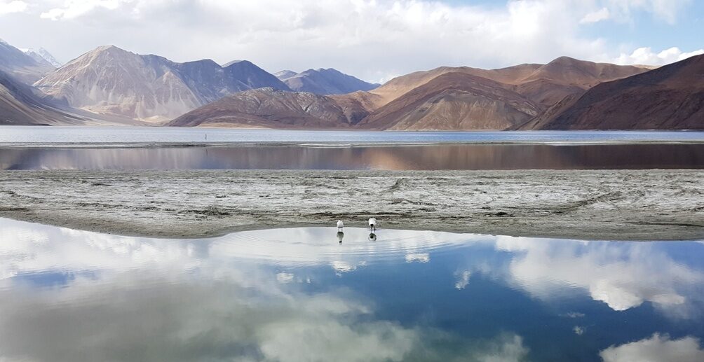
Banner image: Bar headed geese at the Pangong lake, part of Changthang Wildlife Sanctuary in Ladakh. Photo by Samriti Paul/Wikimedia Commons.