- India’s coastal zoning policy requires public consultation only for larger 1:25,000 scale maps that miss marking some commons and other critical infrastructure that coastal communities rely on.
- Smaller scale maps in the scale 1:4,000, based on which infrastructure projects are supposed to be cleared, are difficult for communities to access.
- In Puducherry and Karaikal, communities protested against the draft maps presented in March 2023 and April 2024, in the 1:25,000 scale as they did not mark some eco-sensitive zones and commons.
Everyday, 75-year-old Kannachiamma wakes up at 1 a.m. and travels eight kilometres to the Karaikal harbour in the union territory Puducherry, to buy fish. By 4 a.m., she returns to a fish-drying centre near her village and starts meticulously cleaning and salting each fish before laying them on the concrete floor of a drying centre. The fish takes around three to four days to dry and once dried, she packs them up in a sack and sells them at the same harbour. “There is no profit really but on a good day I might earn ₹1,000. And that is how I survive,” said Kannachiamma. The fish drying centre, she said, is what her life depends on.
The drying centre is only a 300 square metre-concretised patch on both sides of Mandapathur road in Karaikkal with small storage huts made of bamboo and tarpaulin sheets at the edges. For almost half of the women in the fishing villages of Akkampettai, Kilinjalmedu and Karaikalmedu in Puducherry, drying and selling fish is the primary source of livelihood, which is dependent on being able to access centres like these.
However, India’s coastal regulation policy falls short in ensuring communities’ rights over commons like these drying centres.
The Coastal Regulation Zone notification aimed at protecting fragile coastal ecosystems, categorises land up to 500 metres from the high tide line into zones, with each zone receiving different kinds of protection. A key part of this zoning exercise is the drafting of the Coastal Zone Management Plans (CZMP). The CRZ notification mandates states and union territories to draft these plans and to seek public consultation for them before seeking approval from the central environment ministry.

But there is a catch. The guidelines demand CZM maps to be drawn on a scale of 1:25,000. At this scale, one grid covers nearly 14 × 14 kilometres or 196 sq.km. The map is so large that commons like the drying centres are barely visible, making it impossible for the community members to provide meaningful consultation.
While the notification also demands creation of smaller 1:4,000 scale local maps, these do not undergo the public consultation process.
This scale difference is important, especially in coastal areas because the coast, as a natural boundary, has curves, minute details and crevices. So, the closer one looks at the coast, the more details become visible. This is called the coastline paradox and one of the reasons why India’s coastline increased from 7,500 kilometres to almost 11,100 kilometres last year. The previous estimate from the 1970s looked at the coast at the scale of 1:4,500,000 while the new estimate is computed at the scale of 1:250,000.
Beside missing details, the 1:25,000 CZM maps fail to translate the complex, fluid engagement that communities have with the coast and its ecology. Fishermen use the space to park their boats, mend nets and fix their boats and in the evenings, it is also where children play.

Community protests against draft plan
The CRZ notification passed in 1991 was amended dozens of times over the years, prioritising business interests over coastal protection. The latest notification, passed in 2019, opened up the coast for real estate, tourism and port sectors.
“The dilution of CRZ has absolutely made it easier for businesses,” said Zaman Ali, an environmental lawyer who is representing the petitioner in an NGT case contesting the constitutional validity of the 2019 notification. The number of activities that have been allowed, including the removal of special status to critically vulnerable areas and contraction of the No Development Zone, shows how these dilutions prioritise business interests over coastal protection, he said.
The draft coastal map released in March 2023 for Puducherry and Karaikal was based on the new notification in the 1:25,000 scale. A large part of the beach stretch of Karaikal was marked as a tourism zone, while the fishing villages were not named. Unhappy with this map, the community members boycotted the public hearing for consultation.
When a public hearing was held in 2018 for the draft plans of the 2011 CRZ notification, 19 representations from the community had raised concerns , but the final plans included none of it. Following this event, the community members did not trust that the government officials would incorporate their concerns in the latest draft of the map, said R.Mangayarselvan, president of the Tamil Meenavar Viduthalai Vengaikal, a political party. “So, they decided to boycott the hearing.”
Traditional fisher panchayats of Puducherry and Karaikal, along with the support of Mangayarselvan’s party, Coastal Peoples’ Right to Life Movement (CPRM) and Karaikal District Fisherwomen’s Federation, protested against the new plan, forcing the union territory government to withdraw it. Later, representatives of the campaign met with officials of Puducherry Pollution Control Committee (PPCC) and the Puducherry Coastal Zone Management Authority (PCZMA) to emphasise the importance of incorporating coastal commons, fishing zones and eco-sensitive areas in the map.
This led to the formation of a team composed of mapping experts, community organisers and government officials, who over two months, with the help of traditional fisher panchayats, mapped fishing villages. “The objective was to map fishing villages including coastal commons. It took two months to map all the fishing villages of Pondicherry and Karaikal districts. The fisher panchayats played an important role in facilitating this process and they formally submitted the prepared maps to Department of Fisheries for concurrence,” noted the Fishing Villages and Commons report prepared by Coastal Peoples’ Right to Life Movement, which was published in July 2025.

After this exercise, a second draft plan was issued in April 2024. While this new draft included fishing villages and some commons, parts, including critical eco-sensitive areas such as some mangroves, sand dunes and turtle nesting sites remained excluded. “There were deviations between the maps submitted by the fisher panchayats and the April, 2024, draft CZMPs, many seine fishing areas were missing in them,” the Commons Report noted.
As per the CRZ notification, the National Centre for Sustainable Coastal Management (NCSCM) in Chennai has to map the eco-sensitive areas, primarily using satellite data. This data is then used by the state and union territories to mark eco-sensitive zones in CZMPs. However, even the NCSCM’s data missed out on over 1,200 acres of such areas, found in an August 2024 report by CPRM, accessed by Mongabay-India. This report, created by a group of ecologists, botanists, experienced field survey experts and a GIS expert, in collaboration with fisher panchayats, found that NCSCM data missed out 70-90% of eco-sensitive areas in Puducherry and Karaikal.
In May 2024, M. Malayalathan, a resident from the village of Veerampattinam in Puducherry approached the National Green Tribunal with a request to squash these maps as they are incomplete and contrary to guidelines issued under the CRZ notification. However, the PPCC submitted a status report to the tribunal stating that all eco-sensitive areas have been marked.
In October 2024, while the case was ongoing in the tribunal, the PPCC released another draft plan, the only difference being addition of some fishing zones and fish breeding areas in the sea. The same petitioner filed another case in the NGT against the new draft plans. The tribunal disposed of this case in August 2025 after the union territory government, PPCC and PCZMA said that they will consider the issues raised by the community and create another draft map incorporating all the changes.
Since then, Malayalathan said he has not heard from the authorities. “Over the last six months, I have written multiple letters to PPCC and PCZMA but have received no response,” he said.
Until the new CZMP gets approved, the coast will continue to be governed by the old CZMPs made based on the 2011 CRZ notification. Mongabay-India reached out to Puducherry CZMA for an update on the latest draft maps and did not receive a response at the time of publishing this story.

Smaller scale maps are difficult to access
This kind of an impasse is not limited to Puducherry, but is happening across coastal states. Only five states and union territories–Karnataka, Kerala, Odisha, Maharashtra and Andaman and Nicobar Islands have approved CZMPs based on the 2019 CRZ notification.
As in Puducherry, coastal communities in Goa, Maharashtra and Tamil Nadu have protested against draft CZMPs because of missing villages, commons and eco-sensitive areas. But no other CZMPs have marked fishing commons, noted Prabhakar Jayaprakash, researcher with CPRM. “In Tamil Nadu, they are trying to mark them but without the participation of fishers and those maps are not published yet. Even in Puducherry, only two districts are marked this way. No similar efforts are being made for Yanam and Mahe,” he said.
The main problem with CZMPs is the scale, said Gajendran, 61, a member of the traditional fisher panchayat in Kilinjalmedu. “Nothing is visible in the maps that the government released, everything is so small that we are not able to assess them properly. We want smaller scale maps because we want to be able to see our villages,” he said.
For fishing communities, coastal land is not property but livelihood infrastructure, said MS Shivakumar, who has worked on issues of land governance for over three decades. “That relational understanding is precisely what CRZ frameworks cannot accommodate, and that incompatibility is what makes diversion towards ports, SEZs, and real estate so structurally easy to achieve through the CZMP,” he added.
The CRZ notification demands the creation of two kinds of maps–the primary 1:25,000 CZM Maps and local level CZMP maps at 1:4,000 scale which are also referred to as cadastral maps. As per the notification, states and union territories first have to draft the larger 1:25,000 scale map, release it for public consultation and then get it approved by the union environment ministry. Then, the smaller local level maps are made to implement the approved plan.
While eco-sensitive areas have to be marked on the larger map, fishing villages, commons and other local infrastructure are to be marked on the local maps. “The fishing villages, common properties of the fishermen communities, fishing jetties, ice plants, fish drying platforms or areas infrastructure facilities of fishing and local communities such as dispensaries, roads, schools, and the like, shall be indicated on the cadastral scale maps. States and Union territories shall prepare detailed plans for long term housing needs of coastal fisher communities in view of expansion and other needs, provisions of basic services including sanitation, safety, and disaster preparedness,” reads the CRZ document.

These local maps don’t go through a public consultation process like the primary map and can only be made by superimposing on the approved CZM maps. “They cannot demarcate new zones but only add more details in the existing ones. So, we are demanding the larger scale map to include everything,” said Saravanan, the coordinator at the Coastal Resource Centre in Chennai, who has been supporting communities across Tamil Nadu and Puducherry with participatory mapping.
But in reality, these local maps are rarely made, said Ali. “There could be a few examples here and there but in the majority of cases, they never get made,” he said.
However, one of the documents that any new project proponents such as residential buildings or hotels have to submit to Coastal Zone Management Authorities (CZMA) while seeking clearance, is the 1:4000 scale local map. They hire NCSCM to make special ones only for their project areas, Ali notes. “These private entities have all the resources to fund NCSCM to make local maps only for their project area. And very often we see that there is a sudden change. Stating that 1:25,000 maps are incorrect, these local maps mark areas that were marked as CRZ 1b as CRZ 3b, reducing the level of protection and enabling CZMAs to allow the project,” said Ali, while explaining that CRZ-I B are intertidal areas and are categorised as most critical environmentally, while CRZ-III B are sparsely populated land areas.
These maps, even when made, are practically impossible for communities to access. “All CZMAs have separate websites where they publish the final plans, which ideally should also include 1:4,000 scale maps for every taluka. District collectorates, revenue departments and even certain gram panchayats have their own websites. Eventually, these maps have to be reflected on some of these but they are not uploaded anywhere,” added Ali.
Often, the only way for communities to access these local maps is to file RTI applications or approach the court, he said. “Responses to RTI applications usually say that the local map is not prepared or it is yet to be prepared. So, ultimately, they have to approach the court. You can’t expect every village or coastal village or every coastal district to file a case.”
Need for community-centric planning
Most of the land that coastal communities depend on like beaches and inter-tidal areas are coastal commons, where they have customary rights. But there is no comprehensive law protecting communities’ access to these spaces. In such a landscape, the CRZ notification is the only legal framework that refers to these customary rights over coastal land and the sea, said Ali. And exclusion of fishing villages or lack of demarcation of commons makes these communities more vulnerable to displacement, he added.
Moreover, climate change and anthropological factors such as coastal development projects are changing the nature of the coast. Between 1990 and 2016, over a third of India’s coast faced erosion of varying degrees. Long-term cumulative shoreline analysis of the coast from 1990 to 2016, indicates that 57% of Puducherry’s coast is in eroding condition. Residents say that a huge stretch of the coast in Veerampattinam was swept away in December 2025 because of the heavy rains and winds from the Ditwah cyclone. “The sea took away an entire row of fishing nets that were lying on the beach,” said R Arumugam, 48, a fisherman from the village.

As erosion and increased diversion of coastal land squeezes communities, fishing communities are also demanding governments to provide long-term housing plans, as mentioned in both 2011 and 2019 notifications.
But none of the plans so far has made such plans, despite availability of land, said Jesu Rathinam, an activist and lawyer working with coastal communities, “The state should take the steps to acquire that land and create long-term housing plans for the community. Land should not be diverted for other reasons while the communities are in need.”
Explore a map: What a coastal zoning map leaves out
Shreya Raman is a resident fellow at the Climate Change Media Hub, Asian College of Journalism.
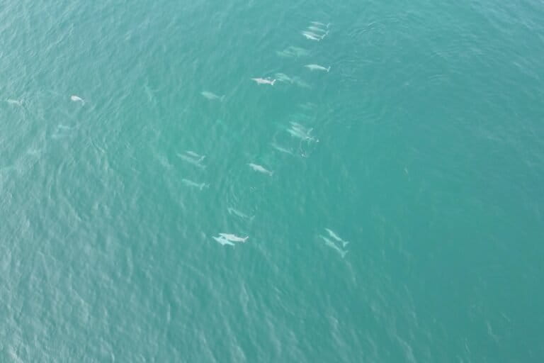
Banner image: Fishermen in Chinna Veerampattinam, Puducherry. Image by Shreya Raman.