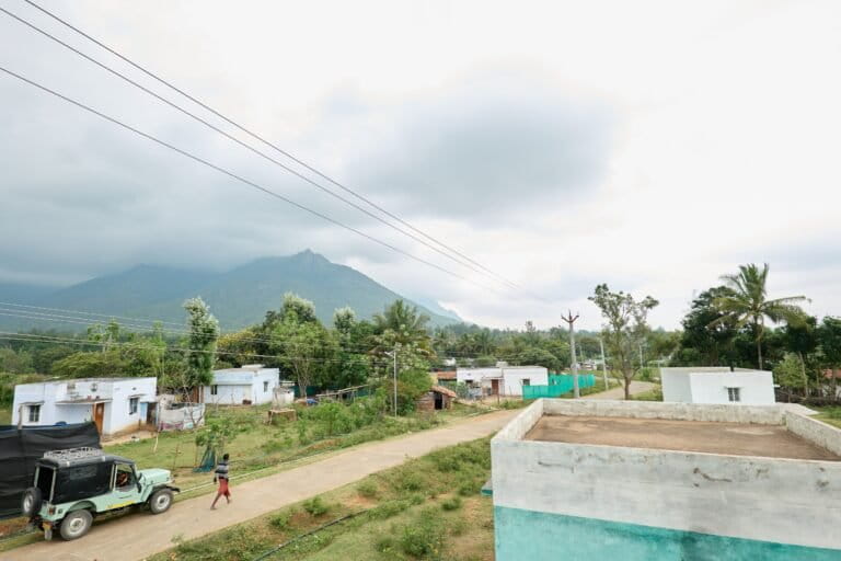
- Chokkanalli village in the Sigur plateau has seen decades of ecological change that transformed the Sikkole river, a lifeline of the Irula community.
- Driven by deforestation, land-use change, hydropower dams, and erratic rainfall, the river now flows thin, altering wildlife movement, agriculture, and water security.
- These shifts have reshaped indigenous livelihoods, with the Irula community losing access to traditional farming, forest foods, fish, and clean water.
- B. Vijayarani, an Irula woman, offers a first-person account of these changes in this piece.
The Sikkole River, a lifeline for various Indigenous communities in the Sigur Plateau in Tamil Nadu, has undergone dramatic transformations over the past five decades, fundamentally altering the lives of Indigenous residents and the ecosystem they depend upon.
The Sigur Plateau, a part of the Nilgiri Biosphere Reserve, is a significant wildlife habitat and ecological corridor in the Nilgiris district. It serves as an important migration route for elephants and other wildlife. The plateau’s dry deciduous forests support a unique mix of flora and fauna, including elephants, deer, vultures, and numerous endangered species. The plateau has also been home to the Indigenous communities of Irula, Jenukurumba and the Soliga, among others.
In this piece, B. Vijayarani (42), a resident of Chokkanalli village, writes a first-person account recalling a time when poverty and hunger were strangers to her community.

Until I was 20 years old, the Sikkole River, also called the Chokkanalli River, provided everything: grains from traditional farmland, honey, greens, fruits and tubers from the forests, and abundant fish from the waters. We didn’t have the facilities we have now, but we never went hungry. Our stomachs were filled to the brim.
In the Irula language, rivers are called kere and small streams are konjiri. The Sikkole River, also known as the Maheshwar River, is formed by the confluence of the Kallatti, Solur, and Odiyalla rivers, along with water from the Kamarajar dam, the Karuveppilai Estate River, and numerous smaller streams. The name Sikkole has dual meanings: in Kannada, sik means small and kole means river, together forming “small river.” Alternatively, it translates to a “river that washes away sins”. The river eventually cascades into Moyar falls at the Moyar gorge.
The elders in our Irula community remember a different weather. My parents have told me that our village received heavy rainfall regularly 40-50 years ago. If it rained in the Kallatti area, it would definitely rain in Chokkanalli too. In those times, small streams maintained continuous water flow after the rains — a phenomenon that no longer happens. Today, water remains in the streams for only a few days.
How our river transformed
Historically, villages near the riverbanks thrived, and Chokkanalli was no exception. Since our village sits adjacent to the river, water was used not only for drinking but also for washing clothes, bathing, swimming, fishing, cleaning tubers, and tending to cows and buffaloes — all activities carried out with joy and ease.
Our ancestors spent much of their time on the riverbanks, building huts and raising livestock, primarily cattle belonging to the Badaga community which they grazed in forest lands. The Irula people of the Sigur area maintained a harmonious relationship with the Badaga community as caretakers of their buffalo and cattle until the Badaga people relocated their livestock to their own residential areas following instructions from the forest department.
The river and its surrounding areas once teemed with wildlife and birds. Baya weaver birds, in particular, were abundant. Today, their nests can only be found in the Masinagudi area, and new bird species have begun appearing in their place.
Our Irula community has depended primarily on small-scale millet farming for their livelihood. Village life centred around cultivating traditional crops using age-old farming methods: finger millet, little millet, ragi, various legumes, pumpkin, and maize. The river provided fish species such as kende meen, English meen, mekka meen, and venne satti meen — the latter, according to our ancestors, is found nowhere else but in Sikkole River.


Due to deforestation and reduced rainfall, water flow in the river began diminishing. Between 10 and 15 years ago, the Chokkanalli stretch of the river dried up completely. All 24 rivers in this basin drain into the Moyar basin, which flows into the Bhavani reservoir. While Moyar remains one of the few perennial rivers in the Nilgiris with thick riparian vegetation, its flow has reduced significantly.
In my conversation with Gokul Halan, a Nilgiris-based hydro-ecologist and development practitioner, he gave a scientific explanation to the multiple factors behind this decline. “There are land use changes, hydropower dams, diversions for agriculture and industries, tea estate irrigation in the catchments, and quite recently, a number of resorts drawing large volumes of water to run their wildlife tourism facilities. Add to that the erratic rainfall because of climate change, and it all adds up,” he said.
Between 1956 and 1964, the Kamarajar Sagar dam (also known as the Shanti Nalla reservoir) was constructed on the Shantinalla River to provide irrigation and reliable water supply to surrounding agricultural areas. Located 10 kilometres from the Ooty Bus Stand on Gudalur road, the dam has become both a tourist attraction and a film shoot location. It has also played a significant role in changing the our community’s relationship with the river.

An unending search for water
The Sigur Water Resources Project Report, compiled by the Nilgiris-based non-profit Keystone Foundation in 2007, notes that the Sigur plateau, situated in the rain-shadow region of the Nilgiris, had a persistent surface water problem. For years, the forest department and local stakeholders had attempted to address this by building check dams and percolation tanks to improve groundwater levels.
When the Sikkole River dried up, we residents struggled to find alternative water sources for everyday needs. Traditional methods of drawing water from streams and rivulets changed as resorts proliferated in the area. Halan explained to me that each of these resorts dug borewells and pumped water, and the groundwater level reduced, which is the main reason that the river dried up, too. We had to start purchasing water because of the intensity of the drought which neither the people nor the forest department had anticipated.
The Kamaraja Sagar dam which was first opened in 1963, was opened again in 2018 to provide relief to this water-scarce region. However, this solution brought new problems. “The water in the dam had been collected over a long time, and when it was released downstream, pollutants from the upper plateau’s settlements and chemical runoffs were concentrated in the water that flowed below,” Halan notes.
The water pumped through wells for daily use would be cloudy. This was particularly noticeable when it was stored in pots with the dirt in it evident. Our food was turning yellow. We had to dig deeper and deeper for water.

Having worked extensively in the Sigur region, Halan recalls disturbing reports from my village, Chokkanalli, in response to which our residents tested the water quality and found that the iron content was very high. Many people reported skin diseases and boils. The problem was compounded by Ooty town’s waste and drainage system flowing into a wetland near the Kamarajar Sagar dam, which had seeped into the water supply and remained stagnant.
Halan and his team worked to increase awareness of water safety methods, including boiling water before consumption and reducing open defecation in the area. However, the challenges extended beyond water quality. “The people of Chokkanalli had long been forest-dependent,” he explains. “Since the safari culture and wildlife tourism in the neighbouring Masinagudi (Mudumalai) Tiger Reserve intensified, people’s lifestyle changed and they became increasingly dependent on tourism-generated forms of labour.” This intensified usage created additional water problems. “Sigur plateau actually falls in a rainshadow region,” he adds. “That’s why rainfall here is quite uneven. The western side of Sigur gets an average of 500 mm a year, mostly from the southwest monsoon, while the eastern side depends on the northeast monsoon.”
Our community has been witness to these slow, steady changes. Trees and grass disappeared, leading to animal starvation and deaths. Small-scale millet farming became impossible. Domestic livestock faced water rationing, and wild animals began moving towards our villages in search of water, creating new patterns of interaction and conflict that persist even today. Trees, shrubs, vines, and grass withered. Some fruit trees vanished entirely. As stewards of these forests, our community members have orally documented these changes.
Except for occasional incidents, human-wildlife conflicts were rare in the past. But when the river dried up completely, the dynamic shifted. Wild animals began entering the village for water. Having lost their traditional routes, animals now pass through the village and cultivated lands to reach water and raid crops, significantly increasing human-wildlife conflicts. Efforts by the forest department are now underway to mitigate conflicts by redirecting wildlife paths.
Despite the river flowing through forests, the river water has never been exclusively for wildlife. For generations, my people have depended on river water for drinking, agriculture, and livestock care. The forest department, however, does not permit us to use this water now. And we have had to fight for the right to access our river.
Although people consider the Chokkanalli River as one that washes away sins, it has become increasingly polluted over time. For us, the river’s decline is not just another environmental problem but an erosion of a way of life that sustained us for generations.
This series is published in collaboration with Keystone Foundation and the stories are written by the members of the indigenous communities of the Nilgiri Biosphere Reserve.
Read more: Tubers and tribals face the climate test
Banner image: The Sikkole River. Image courtesy of Keystone Foundation.